North America Map
North America Map > North America Travel • Political Map • Relief Map
To display a detailed political map or relief map of North America, click on the respective North America map or caption shown below.
 |
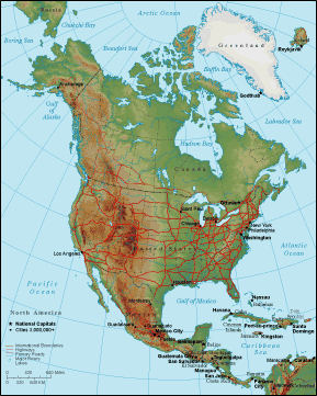 |
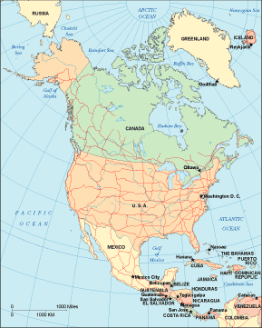
| North America Political Map | North America Relief Map |
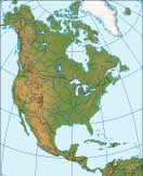
The Mississippi and Missouri river runs through the United States for about 3,741 miles. Lake Superior, the largest lake in North America at 31,820 square miles, lies partly in Canada and partly in the USA. The Coastal Range and the Rocky Mountains run down the west coast of North America from Alaska in the north to Central America in the south. The fairly level Canadian Shield and the Great Plains make up much of the central interior, while the Appalachian Mountains and the Atlantic coastal plain are found in the eastern part of North America.
Detailed North America Maps
North America includes Canada, the United States of America, Mexico, and the nations of Central America, as well as Greenland and the Caribbean islands. Mexico City is the largest North American city; New York is the largest city in the United States; Toronto is the largest city in Canada. Holt, Rinehart and Winston features printable maps of North America as well as maps and basic demographic information about North America's countries and regions. For maps and travel information about Canada and Mexico, please visit Canada Map and Mexico Map. For detailed road maps and topo maps of the United States, please see United States Map. For maps and information about each state in the USA, visit the United States Atlas.
Related Continent Map Websites
- Map Of Africa - African maps and travel information.
- Map Of Antarctica - Antarctic map and travel destinations.
- Map Of Asia - Asia political map, relief map, and topographic map.
- Map Of Australia - Australian political, relief, and topo maps.
- Map Of Europe - European maps and travel information.
- Map Of South America - South American political and topo maps.
About Us.